Stages of the Camino Francés Route: The Complete Pilgrim's Guide
Posted: | Updated:
Reading time: 30 minutes
Posted: | Updated:
Reading time: 30 minutes

By: Simon Kemp , Editor
Welcome to an English language guide to the complete route of the Camino Francés otherwise known as the French Route of the Camino Francés (Way of St. James). This is the main Camino de Santiago pilgrimage route in Spain going from St Jean Pied Du Port in the French side of the Pyrenees to Santiago De Compostela in Galicia. The other is the Via De La Plata going from Seville in the south of Spain via Astorga in the north.
Some of the contents of this site come from my first Camino website and it has now been updated and lots of new information added for the contemporary pilgrim or hiker.
I have walked most parts of this route more than once. I walked the section from St Juan to Burgos most recently in March 2004. My partner and I have walked the section from Burgos to Sarria in 2003 and I walked the whole Camino Francés in 2000.
The comments in the place descriptions below are my own personal and subjective impressions of the places I visited. They reflect my own likes and dislikes and they should be treated accordingly when read.
If you are considering a camino adventure then take a look at my camino packing guide. It’s important to get advice from people who have walked the Camino regarding what to pack. Pack light is the mantra, but there are a couple of other bits and pieces that you will need.
Table of Stages of the Camino Francés Route
The following is a fairly comprehensive list of all the stages in the Camino Francés Route, along with distances between destinations and the type of terrain you will encounter.
Variations of Route stopping points
All of these lists of route points are different because they can vary according to several factors:
- How much distance you want to cover in a single day
- Your Stamina
- How much time you have overall
- Whether you want to pass through a town or stop overnight
- If you are walking the entire Camino or just a single stage
| Stage | From | To | Distance (km) | Distance (miles) | Terrain | Landmarks |
|---|---|---|---|---|---|---|
| 1 | Saint-Jean-Pied-de-Port | Roncesvalles | 25 | 16 | Mountainous | Valcarlos, Ibañeta Pass |
| 2 | Roncesvalles | Zubiri | 22 | 14 | Hilly | Espinal, Larrasoaña |
| 3 | Zubiri | Pamplona | 20 | 12 | Rolling hills | Puente de la Rabia, Pamplona Cathedral |
| 4 | Pamplona | Puente la Reina | 24 | 15 | Rolling hills | Alto del Perdón, Cirauqui |
| 5 | Puente la Reina | Estella | 22 | 14 | Mostly flat | Maneru, Church of San Pedro |
| 6 | Estella | Los Arcos | 22 | 14 | Rolling hills | Monastery of Irache, Villamayor de Monjardin |
| 7 | Los Arcos | Logroño | 28 | 17 | Flat and rolling hills | Viana, Logroño |
| 8 | Logroño | Nájera | 30 | 19 | Mostly flat | Navarrete, Nájera Monastery |
| 9 | Nájera | Santo Domingo de la Calzada | 21 | 13 | Mostly flat | Azofra, Santo Domingo de la Calzada |
| 10 | Santo Domingo de la Calzada | Belorado | 23 | 14 | Mostly flat | Grañón, Belorado |
| 11 | Belorado | San Juan de Ortega | 24 | 15 | Mostly flat | Villafranca Montes de Oca |
| 12 | San Juan de Ortega | Burgos | 27 | 17 | Mostly flat | Atapuerca, Burgos Cathedral |
| 13 | Burgos | Hontanas | 32 | 20 | Mostly flat | Castrojeriz, Meseta |
| 14 | Hontanas | Boadilla del Camino | 29 | 18 | Mostly flat | Fromista, Itero de la Vega |
| 15 | Boadilla del Camino | Carrión de los Condes | 26 | 16 | Mostly flat | Paredes de Nava, Carrión de los Condes |
| 16 | Carrión de los Condes | Terradillos de los Templarios | 27 | 17 | Mostly flat | Calzadilla de la Cueza |
| 17 | Terradillos de los Templarios | Bercianos del Real Camino | 24 | 15 | Mostly flat | Sahagún, El Burgo Ranero |
| 18 | Bercianos del Real Camino | Mansilla de las Mulas | 27 | 17 | Mostly flat | Reliegos, Mansilla de las Mulas |
| 19 | Mansilla de las Mulas | León | 19 | 12 | Mostly flat | León Cathedral, San Isidoro Basilica |
| 20 | León | Villadangos del Páramo | 21 | 13 | Mostly flat | Hospital de Órbigo, Puente de Órbigo |
| 21 | Villadangos del Páramo | Astorga | 29 | 18 | Rolling hills | Astorga Cathedral, Gaudí’s Palace |
| 22 | Astorga | Rabanal del Camino | 20 | 12 | Gradual climb | Santa Catalina de Somoza, Foncebadón |
| 23 | Rabanal del Camino | Molinaseca | 25 | 16 | Mountainous | Cruz de Ferro, El Acebo |
| 24 | Molinaseca | Villafranca del Bierzo | 32 | 20 | Rolling hills | Ponferrada Castle, Cacabelos |
| 25 | Villafranca del Bierzo | O Cebreiro | 28 | 17 | Mountainous | La Faba, O Cebreiro |
| 26 | O Cebreiro | Triacastela | 21 | 13 | Mountainous | Alto do Poio, Triacastela |
| 27 | Triacastela | Sarria | 19 | 12 | Rolling hills | Samos Monastery, Barbadelo |
| 28 | Sarria | Portomarín | 22 | 14 | Rolling hills | Rente, Portomarín |
| 29 | Portomarín | Palas de Rei | 25 | 16 | Rolling hills | Gonzar, Palas de Rei |
| 30 | Palas de Rei | Melide | 15 | 9 | Rolling hills | Casanova, Melide |
| 31 | Melide | Arzúa | 14 | 9 | Rolling hills | Ribadiso, Arzúa |
| 32 | Arzúa | Pedrouzo | 19 | 12 | Rolling hills | Salceda, Pedrouzo |
| 33 | Pedrouzo | Santiago de Compostela | 20 | 12 | Rolling hills | Monte do Gozo, Santiago de Compostela |
Camino Francés Stages can vary according to your own particular journey Here are descriptions of each stage, what you can expect to find and any interesting landmarks or notable accommodations along the particular route stage. Every travelers experience is different and people notice different things, so I may not mention something that you know well and vice-versa. Please leave a comment if you have had a different experience or think I should have included something important to you!
Camino Francés: Route Map
The Camino Francés route map is interactive and can be zoomed in or out using the mouse or touchpad gestures. It provides detailed information about each stopping point along the route, allowing you to plan your journey more efficiently. Use this map in combination with the complete list of stopping points provided above to plan your Camino adventure.
Stage 1: Saint-Jean-Pied-de-Port to Roncesvalles
I. Introduction
- Stage 1 is the exciting start of the Camino Francés, taking pilgrims from Saint-Jean-Pied-de-Port to Roncesvalles.
- The stage covers a distance of 25 km (16 miles) with mountainous terrain and takes approximately 7 to 8 hours to complete.
II. Starting Point: Saint-Jean-Pied-de-Port
- Saint-Jean-Pied-de-Port is a picturesque French town located at the foothills of the Pyrenees.
- Points of interest include the Citadel, Notre-Dame-du-Bout-du-Pont, and the old bridge over the Nive river.
- Accommodation options range from albergues and hostels to hotels and guesthouses.
- Services and facilities include shops, banks, pharmacies, and restaurants.
III. Route Description
- Stage 1 begins with a steep climb from Saint-Jean-Pied-de-Port up the Pyrenees.
- The terrain is mountainous, making this one of the most challenging stages on the Camino.
- Key landmarks include the Valcarlos Valley and the Ibañeta Pass.
IV. Alternative Routes
- The Valcarlos Route is a less demanding alternative that follows the valley floor, avoiding the steeper climbs.
- Pros: Lower difficulty, more sheltered from the elements; Cons: Less scenic, slightly longer distance.
V. Destination: Roncesvalles
- Roncesvalles is a small village situated in the Spanish Pyrenees, known for its historic significance.
- Points of interest include the Collegiate Church of Santa Maria and the Charlemagne monument.
- Accommodation options include the iconic Roncesvalles Albergue, hostels, and guesthouses.
- Services and facilities are limited, with a few restaurants and a small grocery store available.
VI. Tips and Recommendations
- A. The best time of year to walk Stage 1 is from late spring to early autumn, as the route may be snow-covered in winter.
- Carry essentials such as water, snacks, sunscreen, and a hat, as well as a map or GPS device.
- Be respectful of fellow pilgrims and local residents, and follow the Leave No Trace principles.
- Enjoy the local cuisine, including French Basque dishes and Spanish tapas, in the towns along the route.
Stage 2: Roncesvalles to Zubiri
I. Introduction
- Stage 2 takes pilgrims from the historic Roncesvalles to the charming town of Zubiri
- The 22-kilometer route is characterized by hilly terrain and takes approximately 5-7 hours to complete
II. Starting Point: Roncesvalles
- A small village known for its monastery, the Royal Collegiate Church of Santa María
- Points of interest include the Royal Collegiate Church and the Pilgrims’ Office
- Accommodation options: albergues, hostels, and hotels available
- Services and facilities: a few shops, restaurants, and a pharmacy
III. Route Description
- The path begins at Roncesvalles and winds through forests, crossing the river Erro
- Terrain consists of hilly sections with some steep inclines and declines
- Key landmarks include the towns of Burguete, Espinal, and the medieval bridge in Larrasoaña
IV. Alternative Routes (if applicable)
- No significant alternative routes for this stage
V. Destination: Zubiri
- A small town situated on the banks of the River Arga
- Points of interest: the 12th-century Puente de la Rabia, a two-arched medieval bridge
- Accommodation options: albergues, hostels, and guesthouses available
- Services and facilities: a few shops, bars, and restaurants
VI. Tips and Recommendations
- Best time of year to walk Stage 2: spring and autumn, when temperatures are moderate
- Essential items to carry: comfortable footwear, rain gear, water, and snacks
- Local customs and etiquette: be respectful of locals and their property, follow the yellow arrows marking the route
- Suggestions for restaurants, bars, and local cuisine: try traditional Spanish dishes like tortilla de patatas and paella at local eateries in Zubiri
Stage 3: Zubiri to Pamplona
I. Introduction
- Stage 3 covers the picturesque journey from Zubiri to the bustling city of Pamplona
- This 20-kilometer route features rolling hills and takes approximately 5-6 hours to complete
II. Starting Point: Zubiri
- A small town on the banks of the River Arga
- Points of interest: the 12th-century Puente de la Rabia, a two-arched medieval bridge
- Accommodation options: albergues, hostels, and guesthouses available
- Services and facilities: a few shops, bars, and restaurants
III. Route Description
- The path from Zubiri to Pamplona goes through the towns of Larrasoaña, Arleta, and Trinidad de Arre
- Terrain consists mainly of rolling hills with some paved sections
- Key landmarks: the medieval bridge in Larrasoaña and the Church of San Pedro in Arre
IV. Alternative Routes (if applicable)
- No significant alternative routes for this stage
V. Destination: Pamplona
- A vibrant city known for the famous San Fermín festival and its historic old town
- Points of interest: Pamplona Cathedral, the Citadel, and Plaza del Castillo
- Accommodation options: a wide variety of albergues, hostels, hotels, and guesthouses
- Services and facilities: numerous shops, restaurants, banks, pharmacies, and supermarkets
VI. Tips and Recommendations
- Best time of year to walk Stage 3: spring and autumn, when temperatures are moderate
- Essential items to carry: comfortable footwear, rain gear, water, and snacks
- Local customs and etiquette: be respectful of locals and their property, follow the yellow arrows marking the route
- Suggestions for restaurants, bars, and local cuisine: try pintxos (small tapas-like dishes) at bars in Pamplona’s old town
Stage 4: Pamplona to Puente la Reina
I. Introduction
- Stage 4 takes pilgrims from the historic city of Pamplona to the medieval town of Puente la Reina
- The 24-kilometer route features rolling hills and takes approximately 6-7 hours to complete
II. Starting Point: Pamplona
- A vibrant city famous for the San Fermín festival and its rich history
- Points of interest: Pamplona Cathedral, the Citadel, and Plaza del Castillo
- Accommodation options: a wide variety of albergues, hostels, hotels, and guesthouses
- Services and facilities: numerous shops, restaurants, banks, pharmacies, and supermarkets
III. Route Description
- The path from Pamplona to Puente la Reina passes through Cizur Menor, Zariquiegui, and Mañeru
- The terrain consists of rolling hills with some steep sections, particularly at the Alto del Perdón
- Key landmarks: the Church of San Andrés in Zariquiegui and the Romanesque bridge in Puente la Reina
IV. Alternative Routes (if applicable)
- No significant alternative routes for this stage
V. Destination: Puente la Reina
- A charming medieval town where the Camino Francés and the Camino Aragonés converge
- Points of interest: the 11th-century Puente de la Reina, the Church of Santiago, and the Church of San Pedro
- Accommodation options: several albergues, hostels, and guesthouses
- Services and facilities: shops, restaurants, banks, and pharmacies
VI. Tips and Recommendations
- Best time of year to walk Stage 4: spring and autumn, when temperatures are moderate
- Essential items to carry: comfortable footwear, sun protection, water, and snacks
- Local customs and etiquette: be respectful of locals, adhere to the designated path, and follow the yellow arrows marking the route
- Suggestions for restaurants, bars, and local cuisine: try local specialties such as lamb, trout, or “pimientos de Piquillo” (red peppers) in Puente la Reina
Stage 5: Puente la Reina to Estella

I. Introduction
- Stage 5 covers the scenic journey from the medieval town of Puente la Reina to the historic city of Estella
- This 22-kilometer route features mostly flat terrain and takes approximately 5-6 hours to complete
II. Starting Point: Puente la Reina
- A charming medieval town where the Camino Francés and the Camino Aragonés converge
- Points of interest: the 11th-century Puente de la Reina, the Church of Santiago, and the Church of San Pedro
- Accommodation options: several albergues, hostels, and guesthouses
- Services and facilities: shops, restaurants, banks, and pharmacies
III. Route Description
- The path from Puente la Reina to Estella passes through Cirauqui, Lorca, and Villatuerta
- The terrain is mostly flat, with some gentle slopes and a few steep sections
- Key landmarks: the Roman road in Cirauqui and the Church of San Pedro in Villatuerta
IV. Alternative Routes (if applicable)
- No significant alternative routes for this stage
V. Destination: Estella
- A historic city with a rich architectural heritage, located on the banks of the Ega River
- Points of interest: the Church of San Pedro de la Rúa, the Palace of the Kings of Navarre, and the Church of San Miguel
- Accommodation options: a variety of albergues, hostels, hotels, and guesthouses
- Services and facilities: shops, restaurants, banks, pharmacies, and supermarkets
VI. Tips and Recommendations
- Best time of year to walk Stage 5: spring and autumn, when temperatures are moderate
- Essential items to carry: comfortable footwear, sun protection, water, and snacks
- Local customs and etiquette: respect locals and their property, stay on the designated path, and follow the yellow arrows marking the route
- Suggestions for restaurants, bars, and local cuisine: try the “tostadas” (toasted bread with toppings) or “bacalao al ajoarriero” (cod with garlic sauce) in Estella
Stage 6: Estella to Los Arcos
I. Introduction
- Stage 6 takes pilgrims from the historic city of Estella to the picturesque town of Los Arcos
- This 22-kilometer route features rolling hills and takes approximately 5-6 hours to complete
II. Starting Point: Estella
- A city known for its rich architectural heritage, located along the Ega River
- Points of interest: Church of San Pedro de la Rúa, Palace of the Kings of Navarre, Church of San Miguel
- Accommodation options: albergues, hostels, hotels, and guesthouses
- Services and facilities: shops, restaurants, banks, pharmacies, and supermarkets
III. Route Description
- The path from Estella to Los Arcos passes through Ayegui, Azqueta, and Villamayor de Monjardín
- The terrain consists of rolling hills, with vineyards and olive groves along the way
- Key landmarks: the Monastery of Irache and its wine fountain, the Castle of Monjardín
IV. Alternative Routes (if applicable)
- No significant alternative routes for this stage
V. Destination: Los Arcos
- A picturesque town featuring a charming main square and several historic churches
- Points of interest: Church of Santa María, Church of San Pedro, and Church of San Lázaro
- Accommodation options: a variety of albergues, hostels, and guesthouses
- Services and facilities: shops, restaurants, banks, and a pharmacy
VI. Tips and Recommendations
- Best time of year to walk Stage 6: spring and autumn, when temperatures are moderate
- Essential items to carry: comfortable footwear, sun protection, water, and snacks
- Local customs and etiquette: respect locals and their property, stay on the designated path, and follow the yellow arrows marking the route
- Suggestions for restaurants, bars, and local cuisine: try the “patatas a la Riojana” (potatoes with chorizo) or “pimientos rellenos” (stuffed peppers) in Los Arcos
Stage 7: Los Arcos to Logroño
I. Introduction
- Stage 7 covers a 28-kilometer stretch from Los Arcos to Logroño, the capital of La Rioja region
- The route consists of flat and rolling hills and takes about 6-7 hours to complete
II. Starting Point: Los Arcos
- A picturesque town featuring a charming main square and several historic churches
- Points of interest: Church of Santa María, Church of San Pedro, and Church of San Lázaro
- Accommodation options: a variety of albergues, hostels, and guesthouses
- Services and facilities: shops, restaurants, banks, and a pharmacy
III. Route Description
- The path from Los Arcos to Logroño passes through Sansol, Torres del Río, and Viana
- The terrain consists of flat and rolling hills, with vineyards and olive groves along the way
- Key landmarks: the Church of the Holy Sepulcher in Torres del Río and the remains of the old walls and castle in Viana
IV. Alternative Routes (if applicable)
- No significant alternative routes for this stage
V. Destination: Logroño
- The capital of La Rioja region, famous for its wine production
- Points of interest: Santa María de la Redonda Cathedral, Church of San Bartolomé, and Puente de Piedra
- Accommodation options: numerous albergues, hostels, hotels, and guesthouses
- Services and facilities: shops, restaurants, banks, pharmacies, and supermarkets
VI. Tips and Recommendations
- Best time of year to walk Stage 7: spring and autumn, when temperatures are moderate
- Essential items to carry: comfortable footwear, sun protection, water, and snacks
- Local customs and etiquette: respect locals and their property, stay on the designated path, and follow the yellow arrows marking the route
- Suggestions for restaurants, bars, and local cuisine: sample the regional wines and traditional tapas, such as “pimientos rellenos” (stuffed peppers) and “patatas bravas” (fried potatoes with spicy sauce), in Logroño
Stage 8: Logroño to Nájera
I. Introduction
- Stage 8 covers a 30-kilometer stretch from Logroño to Nájera, taking approximately 6-8 hours to complete
- The route consists mostly of flat terrain and passes through the heart of La Rioja wine region
II. Starting Point: Logroño
- The capital of La Rioja region, famous for its wine production
- Points of interest: Santa María de la Redonda Cathedral, Church of San Bartolomé, and Puente de Piedra
- Accommodation options: numerous albergues, hostels, hotels, and guesthouses
- Services and facilities: shops, restaurants, banks, pharmacies, and supermarkets
III. Route Description
- The path from Logroño to Nájera passes through Navarrete, Ventosa, and Sotés
- The terrain is mostly flat, with vineyards and olive groves lining the route
- Key landmarks: Church of La Asunción in Navarrete, Church of San Saturnino in Ventosa, and the Monastery of Santa María la Real in Nájera
IV. Alternative Routes (if applicable)
- No significant alternative routes for this stage
V. Destination: Nájera
- A historic town situated along the banks of the Najerilla River
- Points of interest: Monastery of Santa María la Real, Church of Santa Cruz, and the medieval bridge over the Najerilla River
- Accommodation options: albergues, hostels, hotels, and guesthouses
- Services and facilities: shops, restaurants, banks, pharmacies, and supermarkets
VI. Tips and Recommendations
- Best time of year to walk Stage 8: spring and autumn, when temperatures are moderate
- Essential items to carry: comfortable footwear, sun protection, water, and snacks
- Local customs and etiquette: respect locals and their property, stay on the designated path, and follow the yellow arrows marking the route
- Suggestions for restaurants, bars, and local cuisine: try local dishes such as “chuletillas al sarmiento” (grilled lamb chops) and “bacalao a la riojana” (cod in tomato and pepper sauce) in Nájera
Stage 9: Nájera to Santo Domingo de la Calzada
I. Introduction
- Stage 9 covers a 21-kilometer stretch from Nájera to Santo Domingo de la Calzada, taking approximately 4-6 hours to complete
- The route consists mostly of flat terrain and passes through picturesque vineyards and farmlands
II. Starting Point: Nájera
- A historic town situated along the banks of the Najerilla River
- Points of interest: Monastery of Santa María la Real, Church of Santa Cruz, and the medieval bridge over the Najerilla River
- Accommodation options: albergues, hostels, hotels, and guesthouses
- Services and facilities: shops, restaurants, banks, pharmacies, and supermarkets
III. Route Description
- The path from Nájera to Santo Domingo de la Calzada passes through Azofra and Cirueña
- The terrain is mostly flat, with vineyards, farmlands, and small villages lining the route
- Key landmarks: Church of Nuestra Señora de los Ángeles in Azofra, and the Church of Santo Tomás in Cirueña
IV. Alternative Routes (if applicable)
- No significant alternative routes for this stage
V. Destination: Santo Domingo de la Calzada
- A charming town with a rich history and strong ties to the Camino de Santiago
- Points of interest: Cathedral of Santo Domingo de la Calzada, Parador de Santo Domingo, and the Pilgrim’s Bridge
- Accommodation options: albergues, hostels, hotels, and guesthouses
- Services and facilities: shops, restaurants, banks, pharmacies, and supermarkets
VI. Tips and Recommendations
- Best time of year to walk Stage 9: spring and autumn, when temperatures are moderate
- Essential items to carry: comfortable footwear, sun protection, water, and snacks
- Local customs and etiquette: respect locals and their property, stay on the designated path, and follow the yellow arrows marking the route
- Suggestions for restaurants, bars, and local cuisine: try local dishes such as “patatas a la riojana” (potato and chorizo stew) and “peras al vino” (pears in wine) in Santo Domingo de la Calzada
Stage 10: Santo Domingo de la Calzada to Belorado
I. Introduction
- Stage 10 covers a 23-kilometer stretch from Santo Domingo de la Calzada to Belorado, taking approximately 5-7 hours to complete
- The route consists mostly of flat terrain and passes through beautiful countryside and charming villages
II. Starting Point: Santo Domingo de la Calzada
- A historic town with strong ties to the Camino de Santiago
- Points of interest: Cathedral of Santo Domingo de la Calzada, Parador de Santo Domingo, and the Pilgrim’s Bridge
- Accommodation options: albergues, hostels, hotels, and guesthouses
- Services and facilities: shops, restaurants, banks, pharmacies, and supermarkets
III. Route Description
- The path from Santo Domingo de la Calzada to Belorado passes through Grañón and Redecilla del Camino
- The terrain is mostly flat, with beautiful countryside, farmlands, and small villages lining the route
- Key landmarks: Church of San Juan Bautista in Grañón and the Church of La Virgen de la Calle in Redecilla del Camino
IV. Alternative Routes (if applicable)
- No significant alternative routes for this stage
V. Destination: Belorado
- A picturesque town with a rich history and beautiful surroundings
- Points of interest: Church of Santa María, Plaza Mayor, and the medieval walls surrounding the town
- Accommodation options: albergues, hostels, hotels, and guesthouses
- Services and facilities: shops, restaurants, banks, pharmacies, and supermarkets
VI. Tips and Recommendations
- Best time of year to walk Stage 10: spring and autumn, when temperatures are moderate
- Essential items to carry: comfortable footwear, sun protection, water, and snacks
- Local customs and etiquette: respect locals and their property, stay on the designated path, and follow the yellow arrows marking the route
- Suggestions for restaurants, bars, and local cuisine: try local dishes such as “chorizo al vino” (sausage in wine) and “sopa castellana” (garlic soup) in Belorado
Stage 11: Belorado to San Juan de Ortega
I. Introduction
- Stage 11 covers a 24-kilometer stretch from Belorado to San Juan de Ortega, taking approximately 5-7 hours to complete
- The route consists mostly of flat terrain and passes through beautiful countryside and charming villages
II. Starting Point: Belorado
- A picturesque town with a rich history and beautiful surroundings
- Points of interest: Church of Santa María, Plaza Mayor, and the medieval walls surrounding the town
- Accommodation options: albergues, hostels, hotels, and guesthouses
- Services and facilities: shops, restaurants, banks, pharmacies, and supermarkets
III. Route Description
- The path from Belorado to San Juan de Ortega passes through Villafranca Montes de Oca and Tosantos
- The terrain is mostly flat, with beautiful countryside, farmlands, and small villages lining the route
- Key landmarks: Hermitage of Our Lady of Peña in Tosantos and the Church of San Ildefonso in Espinosa del Camino
IV. Alternative Routes (if applicable)
- No significant alternative routes for this stage
V. Destination: San Juan de Ortega
- A small village with a significant history related to the Camino de Santiago
- Points of interest: Monastery of San Juan de Ortega and the Church of San Nicolás
- Accommodation options: albergue and a small guesthouse
- Services and facilities: limited services, a bar, and a small shop
VI. Tips and Recommendations
- Best time of year to walk Stage 11: spring and autumn, when temperatures are moderate
- Essential items to carry: comfortable footwear, sun protection, water, and snacks
- Local customs and etiquette: respect locals and their property, stay on the designated path, and follow the yellow arrows marking the route
- Suggestions for restaurants, bars, and local cuisine: due to limited services in San Juan de Ortega, it’s advisable to carry some food supplies for this stage
Stage 12: San Juan de Ortega to Burgos
I. Introduction
- Stage 12 covers a 27-kilometer stretch from San Juan de Ortega to Burgos, taking approximately 6-8 hours to complete
- The route consists mostly of flat terrain and passes through picturesque landscapes and historical towns
II. Starting Point: San Juan de Ortega
- A small village with historical ties to the Camino de Santiago
- Points of interest: Monastery of San Juan de Ortega and the Church of San Nicolás
- Accommodation options: albergue and a small guesthouse
- Services and facilities: limited services, a bar, and a small shop
III. Route Description
- The path from San Juan de Ortega to Burgos passes through the towns of Agés, Atapuerca, and Villaval
- The terrain is mostly flat, with forests, farmlands, and small villages lining the route
- Key landmarks: Church of Santa Eulalia in Agés and the prehistoric archaeological site of Atapuerca
IV. Alternative Routes (if applicable)
- No significant alternative routes for this stage
V. Destination: Burgos
- A historic city with a rich heritage and beautiful architecture
- Points of interest: Burgos Cathedral, Monastery of Las Huelgas, and the Castle of Burgos
- Accommodation options: albergues, hostels, hotels, and guesthouses
- Services and facilities: shops, restaurants, banks, pharmacies, and supermarkets
VI. Tips and Recommendations
- Best time of year to walk Stage 12: spring and autumn, when temperatures are moderate
- Essential items to carry: comfortable footwear, sun protection, water, and snacks
- Local customs and etiquette: respect locals and their property, stay on the designated path, and follow the yellow arrows marking the route
- Suggestions for restaurants, bars, and local cuisine: try local dishes like “morcilla de Burgos” (blood sausage) and “queso fresco de Burgos” (fresh cheese)
Stage 13: Burgos to Hontanas
I. Introduction
- Stage 13 covers a 32-kilometer stretch from Burgos to Hontanas, taking approximately 7-9 hours to complete
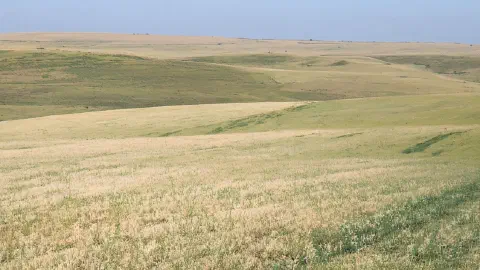
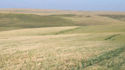
- The route consists mostly of flat terrain, traversing the Meseta and passing through small villages
II. Starting Point: Burgos
- A historic city with a rich heritage and beautiful architecture
- Points of interest: Burgos Cathedral, Monastery of Las Huelgas, and the Castle of Burgos
- Accommodation options: albergues, hostels, hotels, and guesthouses
- Services and facilities: shops, restaurants, banks, pharmacies, and supermarkets
III. Route Description
- The path from Burgos to Hontanas passes through the towns of Tardajos, Rabé de las Calzadas, and Hornillos del Camino
- The terrain is mostly flat, with the vast Meseta dominating the landscape
- Key landmarks: Church of San Esteban in Tardajos and Church of Santa María in Hornillos del Camino
IV. Alternative Routes (if applicable)
- No significant alternative routes for this stage
V. Destination: Hontanas
- A small village located in a natural hollow, offering a peaceful atmosphere
- Points of interest: Church of La Inmaculada Concepción
- Accommodation options: albergues and guesthouses
- Services and facilities: a few bars and a small shop
VI. Tips and Recommendations
- Best time of year to walk Stage 13: spring and autumn, when temperatures are moderate, as the Meseta can be quite hot during the summer months
- Essential items to carry: comfortable footwear, sun protection, water, and snacks
- Local customs and etiquette: respect locals and their property, stay on the designated path, and follow the yellow arrows marking the route
- Suggestions for restaurants, bars, and local cuisine: try local dishes like “cocido castellano” (a traditional stew) and “sopa castellana” (a garlic soup with bread and egg)
Stage 14: Hontanas to Boadilla del Camino
I. Introduction
Stage 14 of the Camino Francés begins in the small village of Hontanas and ends in the equally charming town of Boadilla del Camino. Covering a distance of 29 kilometers, this stage is known for its flat terrain and serene countryside views.
II. Starting Point: Hontanas
- Hontanas is a small and peaceful village located in the province of Burgos
- Points of interest:
- The Church of St. John the Baptist, which dates back to the 16th century and features a beautiful altarpiece
- The Plaza Mayor, which is the main square of the village and has a fountain in the center
- Accommodation options:
- Albergue Municipal de Peregrinos, a public hostel with basic amenities
- Hostal Camino de Santiago, a private hostel with private rooms and a restaurant
- Services and facilities:
- A few small shops selling basic necessities
- A bar
III. Route Description
- The route from Hontanas to Boadilla del Camino is mostly flat and straightforward
- Terrain and difficulty level:
- Mostly dirt tracks and paved roads
- Easy terrain suitable for all fitness levels
- Key landmarks and points of interest along the way:
- The ruins of the San Antón Convent, which was built in the 12th century and used to provide shelter for pilgrims
- The village of Castrojeriz, which has a picturesque castle on a hilltop
- The Canal de Castilla, a man-made canal built in the 18th century that provides stunning views of the surrounding countryside
IV. Alternative Routes (if applicable)
There are no significant alternative routes on this stage of the Camino Francés.
V. Destination: Boadilla del Camino
- Boadilla del Camino is a small and charming town in the province of Palencia
- Points of interest:
- The Church of San Juan Bautista, which has a beautiful altarpiece and a medieval tower
- The Plaza Mayor, which is the main square of the town and has a fountain and a pilgrim statue
- Accommodation options:
- Albergue Municipal de Peregrinos, a public hostel with basic amenities
- Hostal Camino Real, a private hostel with private rooms and a restaurant
- Services and facilities:
- A few small shops selling basic necessities
- A bar
VI. Tips and Recommendations
- The best time of year to walk Stage 14 is from late spring to early fall when the weather is mild.
- Essential items to carry include comfortable walking shoes, sunscreen, a hat, and a refillable water bottle.
- Local customs and etiquette include respecting the privacy of locals and refraining from taking photographs without permission.
- Recommended restaurants in Boadilla del Camino include Mesón Los Templarios and El Palomar.
Stage 15: Boadilla del Camino to Carrión de los Condes
I. Introduction
Stage 15 of the Camino Francés is a 24-km journey from Boadilla del Camino to Carrión de los Condes. This stage offers a mix of beautiful natural landscapes and rich historical and cultural heritage.
II. Starting Point: Boadilla del Camino
- Boadilla del Camino is a small village with a population of around 200 people.
- The village has a 16th-century church dedicated to Saint James and a lovely park along the Canal de Castilla.
- Accommodation options include hostels, hotels, and private rooms.
- Services and facilities include a supermarket, a pharmacy, and a post office.
III. Route Description
- The route starts on a flat dirt road and continues on a mostly flat terrain.
- The highlight of this stage is the Canal de Castilla, a 200-year-old canal system that was once used to transport goods from inland Spain to the coast.
- The path also passes through the picturesque village of Frómista, which is known for its Romanesque church, Iglesia de San Martín, one of the best examples of Romanesque architecture in Spain.
IV. Alternative Routes (if applicable)
- There are no major alternative routes for this stage.
V. Destination: Carrión de los Condes
- Carrión de los Condes is a historic town with a population of around 2,500 people.
- The town has many points of interest, including the 12th-century Romanesque church of Santa María del Camino, the Gothic church of Santiago, and the 18th-century Convento de Santa Clara.
- Accommodation options include hostels, hotels, and private rooms.
- Services and facilities include supermarkets, banks, pharmacies, and a post office.
VI. Tips and Recommendations
- The best time to walk this stage is in the spring or fall when temperatures are milder.
- Essential items to carry include plenty of water, sunscreen, and a hat.
- Be sure to respect local customs and etiquette, such as dressing modestly when visiting religious sites.
- Try the local cuisine, including Lechazo, a roasted lamb dish, and the famous Spanish wine, Ribera del Duero.
Stage 16: Carrión de los Condes to Terradillos de los Templarios
I. Introduction
The Camino Francés is a popular pilgrimage route that starts in the French Pyrenees and ends in Santiago de Compostela, Spain. Stage 16 is a relatively short but challenging 12.5 km walk from Carrión de los Condes to Terradillos de los Templarios.
II. Starting Point: Carrión de los Condes
Carrión de los Condes is a historic town located in the province of Palencia. It has a rich cultural heritage and is home to numerous churches, monasteries, and palaces. Some of the notable attractions in the town include:
- Santa Maria del Camino Church
- San Zoilo Monastery
- Calle Mayor, the main street lined with historic buildings
- Museo de Arte Sacro, a museum displaying religious art and artifacts
There are plenty of accommodation options in Carrión de los Condes, including hostels, guesthouses, and hotels. You can also find several shops, pharmacies, and banks in the town.
III. Route Description
Stage 16 starts in Carrión de los Condes and follows a mostly flat and straight path through the meseta, a vast central plateau in Spain. The route passes through the small villages of Calzadilla de la Cueza and Ledigos before reaching Terradillos de los Templarios.
Some of the key landmarks and points of interest along the way include:
- Puente Fitero, a medieval bridge over the river Carrión
- Ermita de San Miguel, a small chapel with medieval frescoes
- Iglesia de la Asunción de Nuestra Señora, a 16th-century church in Calzadilla de la Cueza
- Iglesia de la Virgen del Carmen, a modernist church in Ledigos
IV. Alternative Routes
There are no significant alternative routes for Stage 16.
V. Destination: Terradillos de los Templarios
Terradillos de los Templarios is a small village with a population of less than 100 people. It is named after the Knights Templar, who used to own land in the area during the Middle Ages. Some of the notable attractions in the village include:
- Iglesia de la Inmaculada Concepción, a 17th-century church with a Baroque altarpiece
- Albergue de Terradillos, a popular hostel for pilgrims
- Mesón El Cid, a restaurant serving traditional Spanish cuisine
- Tienda de María, a small grocery store
There are limited accommodation options in Terradillos de los Templarios, but the village is a popular stopover for pilgrims due to its tranquil and peaceful setting.
VI. Tips and Recommendations
- The meseta can be scorching hot in the summer, so it’s important to stay hydrated and wear sunscreen.
- Bring enough snacks and water for the walk as there are no villages or shops between Carrión de los Condes and Terradillos de los Templarios.
- Check the weather forecast before setting out as the meseta can also be very cold and windy in the winter.
- The albergue in Terradillos de los Templarios tends to fill up quickly, so it’s advisable to arrive early in the afternoon to secure a bed.
- Mesón El Cid is a popular restaurant among pilgrims, but it can get crowded in the evenings, so it’s best to make a reservation if you plan to dine there.
Stage 17: Terradillos de los Templarios to Bercianos del Real Camino
I. Introduction
Stage 17 of the Camino Francés is a 10.6 km walk from Terradillos de los Templarios to Bercianos del Real Camino. This stage is known for its tranquil countryside scenery and offers a relatively easy walk for pilgrims.
II. Starting Point: Terradillos de los Templarios
Terradillos de los Templarios is a small village with a population of approximately 200 people. It is home to the church of Santo Cristo de la Vera Cruz, which dates back to the 16th century.
- Accommodation options include Albergue Ultreia, Albergue San Nicolas de Flue, and Hostal El Apostol.
- Services and facilities in the village include a small grocery store, a pharmacy, and a couple of restaurants.
III. Route Description
The route from Terradillos de los Templarios to Bercianos del Real Camino is relatively flat, making it an easy walk for most pilgrims.
- The terrain is a mix of dirt tracks, gravel paths, and some stretches of asphalt.
- The only notable ascent on this stage is a short uphill climb just before entering Bercianos del Real Camino.
Along the way, pilgrims will pass through several small villages, including San Nicolas del Real Camino and Moratinos. There are also several rest areas and water fountains along the route.
IV. Alternative Routes (if applicable)
There are no significant alternative routes for this stage.
V. Destination: Bercianos del Real Camino
Bercianos del Real Camino is a small village with a population of approximately 250 people.
- The village is home to the church of San Pedro, which dates back to the 12th century.
- Accommodation options include Albergue Casa del Pescador, Albergue San Antonio de Padua, and Hostal Santiago.
- Services and facilities in the village include a small grocery store, a couple of restaurants, and a pharmacy.
VI. Tips and Recommendations
- The best time to walk this stage is in the morning when temperatures are cooler.
- It is recommended to bring plenty of water and snacks for the journey.
- It is important to respect the local customs and traditions of the villages along the way.
- Restaurants in the area are known for their local cuisine, so it is recommended to try some of the traditional dishes.
More Stage Descriptions to Follow Soon!
Already signed up? Go to Camino Resources Hub A VPN will block the signup form below so disconnect to sign up.